How To Read A Weather Map
Added: 20 Nov 2015
Contributor:
Scoilnet
Resource type:
Guide/notes
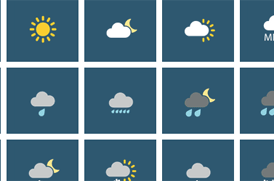
Highly visual guide to understanding and interpreting weather maps. Covers the symbols on a map, UV measurements, air pressure, extreme weather warnings and isobars. It also examines the people who rely on weather forecasting, and how weather conditions affect people in their day-to-day lives.
How it maps to the curriculum
Strand: Mapping & Geog Skills
Suggestions for use: This site would display very well on the class computer or IWB. Take the time to plan a class using this as the core resource.
Strand: Mapping & Geog Skills
Suggestions for use: This site would display very well on the class computer or IWB. Take the time to plan a class using this as the core resource.
- JC
- Geography
Strand: 1. Exploring the Physical World
Strand unit: 8. Gather, Record & Interpret Weather Data
Suggestions for use: Excellent to introduce students to basic understanding of weather and the things to look at when reading a weather forecast.
Key Skills:
- Managing Information and Thinking