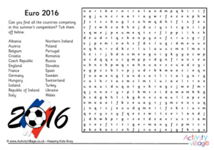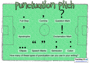
What do you know about the Geography of Europe and of the countries playing in Euro 2016
Flag Colouring
https://www.activityvillage.co.uk/euro-2016-colouring-pages Added: 13 Jun 2016 Contributor: Scoilnet Resource type:Worksheets to colour in each countries flag...along with other colouring activities.
View full description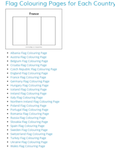
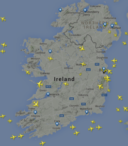
Flight Radar 24: Learning About Countries
https://www.flightradar24.com/53.33,-6.25/7 Added: 10 Jun 2016 Contributor: Scoilnet Resource type: Guide/notes / Reference / SimulationTechnology is really taking off with this mind-blowing website (also available as an APP - Really recommend). Transform your geography lesson into adventure by discovering where planes are flying to and from or track their movement. Zoom in to see the planes tracking more ground. Can you find the country with the most flights? What effect could flight travel have to our ecosystem?
View full descriptionHow it maps to the curriculum
Strand: Mapping & Geog Skills
Suggestions for use: Use maps when learning about the location of other countries. Ask students to document where people can fly to from Ireland. Introduce the aspect zooming in and zooming out.
Strand: Mapping & Geog Skills
Suggestions for use: Use maps when learning about the location of other countries. Ask students to document where people can fly to from Ireland. Introduce the aspect zooming in and zooming out.
- JC
- Geography
Strand: Supplementary Resources
Suggestions for use: Use maps when learning about the location of other countries. Ask students to document where people can fly to from Ireland. Introduce the aspect zooming in and zooming out.
Key Skills: Being Creative Communicating Managing Information and Thinking Staying Well Working with Others Managing Myself
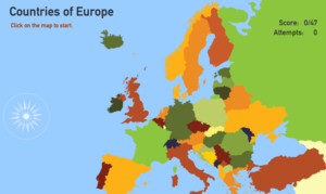
Countries of Europe
http://www.toporopa.eu/en/countries_of_europe.html Added: 26 Mar 2012 Contributor: Scoilnet Resource type: GameCovers all the countries of Europe. Click on possible location of a country and see how well you do. Some of the countries are tougher than you might think. Irish version of the quiz available at http://www.toporopa.eu/ie/european_union_countries.html.
View full descriptionHow it maps to the curriculum
- 5-6
- SESE Geography
Strand: Mapping & Geog Skills
Suggestions for use: Introduce the labeling of countries with this funny video: https://www.youtube.com/watch?v=CozbhIX5Y0E.
Use this resource on classroom computer or IWB. Get the children to collaborate and answer the questions. Some countries are easy but others are tought. Very visual so it will engage the children.
Interactive Geography Quizes - Toporopa
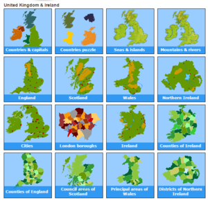
http://www.toporopa.eu/en/index.html Added: 28 Mar 2012 Contributor: Scoilnet Resource type: GameTrain your brain using these interactive Geography quizzes. Quizzes included are on countries, capitals, sea, islands, mountains, rivers, England, Scotland, Wales, Northern Island, Cities in Ireland & UK, Ireland, counties of Ireland, counties of England, districts of Northern Ireland, countries, rivers, flags, mountains, seas, the EU, capitals, monarchies, regions, islands, the eurozone, battles, volcanoes and lakes.
View full descriptionHow it maps to the curriculum
Strand: Natural Environments
Strand unit: Physical Features
Suggestions for use: Very visual resource which would be ideal for the IWB or class computer. Get the children to call out the correct answers or target individual children for answers. Children could also use independently but there are a lot of countries so it could take some time.
Strand: Mapping & Geog Skills
Suggestions for use: Very visual resource which would be ideal for the IWB or class computer. Get the children to call out the correct answers or target individual children for answers. Children could also use independently but there are a lot of countries so it could take some time.
Strand: Natural Environments
Strand unit: Physical Features
Content objective: This resource should enable a child to:
- become familiar with the names and approximate location of a small number of major world physical features
- learn about a small number of the major natural features of Europe
Suggestions for use: Very visual resource which would be ideal for the IWB or class computer. Get the children to call out the correct answers or target individual children for answers. Children could also use independently but there are a lot of countries so it could take some time.